2016
NN1067 : West Highland Way above Blàr a' Chaorainn
taken 8 years ago, near to Blàr a' Chaorainn, Highland, Scotland
This is 1 of 4 images, with title starting with West Highland in this square
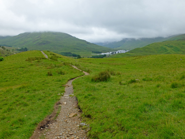
West Highland Way above Blàr a' Chaorainn
Lochan Lunn Dà-Bhrà in the distance.
West Highland Way
The West Highland Way is a long distance footpath, running for 154km (96miles) between Milngavie and Fort William.
It passes through countryside north of Glasgow, follows the east shore of Loch Lomond to Glen Falloch and Strathfillan, crosses Rannoch Moor to the head of Glencoe, climbs the Devils Staircase and descends to Loch Leven, before crossing the Lairigmor and Glen Nevis to finish in Gordon Square, Fort William.
 Map © Crown Copyright")
TIP: Click the map for more Large scale mapping
- Grid Square
- NN1067, 17 images (more nearby 🔍)
- Photographer
- John Allan (more nearby)
- Date Taken
- Monday, 11 July, 2016 (more nearby)
- Submitted
- Monday, 18 July, 2016
- Subject Location
-
OSGB36:
 NN 102 672 [100m precision]
WGS84: 56:45.4651N 5:6.3336W - Camera Location
-
OSGB36: NN 102 673
- View Direction
- South-southwest (about 202 degrees)