2016
SZ1195 : Throop: bungalow on Yeomans Road
taken 8 years ago, near to Throop, Bournemouth, Christchurch & Poole, England
Throop: bungalow on Yeomans Road
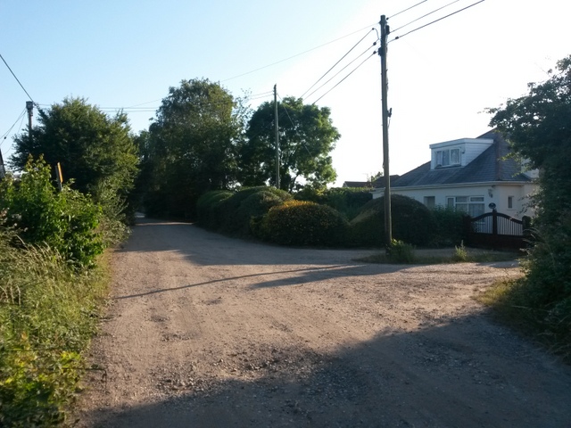
Yeomans Road is one of the original tracks in the Throop area. Today, the southern segment is one of the main roads onto the modern housing estate, but its northern section is still a gravel road. The gravel section forms a public right of way - a byway open to all traffic (or B.O.A.T.) number K21 - and here we look southward past one of the properties straggled along the road. The numbering seems a little irregular, but this is one of a few consecutively numbered houses on the west side.
See SZ1195 : Throop: passing 19 Yeomans Road for the next view on the road ahead, and SZ1195 : Throop: passing some houses on Yeomans Road for the next view behind us - each with links to further photos along the route.
See SZ1195 : Throop: passing 19 Yeomans Road for the next view on the road ahead, and SZ1195 : Throop: passing some houses on Yeomans Road for the next view behind us - each with links to further photos along the route.
Public rights of way in Bournemouth
A series of pictures documenting the public rights of way in the borough of Bournemouth. The pictures of the rights of way all have links to the next picture on the same route, in each direction.
The rights of way are all documented, in numerical order, in this article:
Link
 Map © Crown Copyright")
TIP: Click the map for more Large scale mapping
- Grid Square
- SZ1195, 126 images (more nearby 🔍)
- Photographer
- Chris Downer (more nearby)
- Date Taken
- Wednesday, 20 July, 2016 (more nearby)
- Submitted
- Wednesday, 20 July, 2016
- Subject Location
-
OSGB36:
 SZ 1130 9518 [10m precision]
WGS84: 50:45.3665N 1:50.4702W - Camera Location
-
OSGB36: SZ 1130 9518
- View Direction
- Southwest (about 225 degrees)