2016
SK2256 : Footpath to Longcliffe
taken 8 years ago, near to Longcliffe, Derbyshire, England
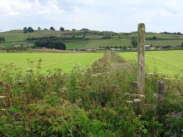
Footpath to Longcliffe
Although quite overgrown in places, the path appeared to be in regular use, at least up to the main road. On the other side of the road, the stile and footpath marker were almost totally smothered in bindweed. The High Peak Trail is in the background and an abandoned quarry is just behind that.
 Map © Crown Copyright")
TIP: Click the map for more Large scale mapping
- Grid Square
- SK2256, 21 images (more nearby 🔍)
- Photographer
- Ian Calderwood (more nearby)
- Date Taken
- Thursday, 21 July, 2016 (more nearby)
- Submitted
- Thursday, 21 July, 2016
- Subject Location
-
OSGB36:
 SK 2278 5631 [10m precision]
WGS84: 53:6.2102N 1:39.6724W - Camera Location
-
OSGB36: SK 2271 5646
- View Direction
- South-southeast (about 157 degrees)