2016
TQ1519 : Four Acres/Limekiln Field/Three Acres/Half Acre Plat
taken 8 years ago, near to Dial Post, West Sussex, England
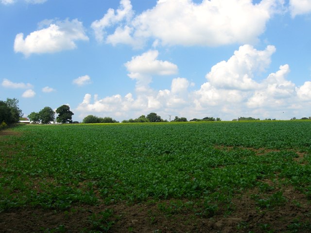
Four Acres/Limekiln Field/Three Acres/Half Acre Plat
The name of the fields according to West Grinstead's 1841 tithe map that have been merged to form a larger unit. Four Acres was in the foreground in the south east corner, Limekiln Field occupied the northeast corner, Half Acre Plat was in south west adjacent to Thistleworth Farm and Three Acres was to its north.
 Map © Crown Copyright")
TIP: Click the map for more Large scale mapping
- Grid Square
- TQ1519, 75 images (more nearby 🔍)
- Photographer
- Simon Carey (more nearby)
- Date Taken
- Saturday, 23 July, 2016 (more nearby)
- Submitted
- Tuesday, 26 July, 2016
- Subject Location
-
OSGB36:
 TQ 1565 1901 [10m precision]
WGS84: 50:57.5353N 0:21.2807W - Camera Location
-
OSGB36: TQ 1580 1900
- View Direction
- WEST (about 270 degrees)