2016
NN4397 : Allt Yairack
taken 8 years ago, 3 km from Melgarve, Highland, Scotland
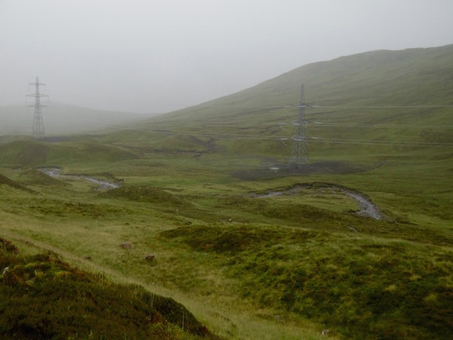
Allt Yairack
The Badenoch side of the Corrieyairack Pass on a wet morning. Ground around the new Beauly - Denny pylons has been restored.
 Map © Crown Copyright")
TIP: Click the map for more Large scale mapping
- Grid Square
- NN4397, 2 images (more nearby 🔍)
- Photographer
- Richard Webb (more nearby)
- Date Taken
- Friday, 22 July, 2016 (more nearby)
- Submitted
- Tuesday, 26 July, 2016
- Subject Location
-
OSGB36:
 NN 4392 9780 [10m precision]
WGS84: 57:2.6863N 4:34.4583W - Camera Location
-
OSGB36: NN 4399 9798
- View Direction
- South-southwest (about 202 degrees)