2007
H9596 : Bellaghy Bawn
taken 17 years ago, near to Bellaghy, Co Londonderry, Northern Ireland
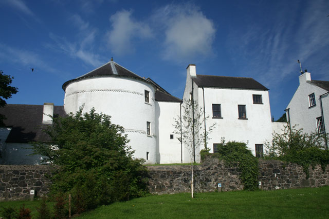
Bellaghy Bawn
Marked as Bellaghy Castle on OS maps, this building is more correctly called a Bawn. A Bawn is a fortified house. This one was built as part of the Plantation of Ulster by the Vintners' Company of London who were granted the land around Bellaghy in 1619. It was intended as a place of refuge in times of trouble. The round tower in the photograph dates from at least 1622.
Loading map... (JavaScript required)
- Grid Square
- H9596, 66 images (more nearby 🔍)
- Photographer
- Cormac Duffin (more nearby)
- Date Taken
- Sunday, 22 July, 2007 (more nearby)
- Submitted
- Wednesday, 25 July, 2007
- Subject Location
-
Irish:
 H 953 963 [100m precision]
WGS84: 54:48.3296N 6:31.1225W - Camera Location
-
Irish: H 953 963
- View Direction
- WEST (about 270 degrees)