2007
SO8540 : The Plough - Flooded
taken 17 years ago, near to Upton Upon Severn, Worcestershire, England
This is 1 of 2 images, with title starting with The Plough in this square
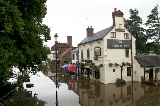
The Plough - Flooded
The 20th July 2007 deluge caused gridlock on the Midlands' roads preventing the delivery of Upton's flood prevention barriers. In the end the subsequent flood was so great it would have defeated the barriers anyway. This was taken from the bridge two days after the peak of the flooding (when access into the town became possible).
 Map © Crown Copyright")
TIP: Click the map for more Large scale mapping
- Grid Square
- SO8540, 1237 images (more nearby 🔍)
- Photographer
- Bob Embleton (more nearby)
- Date Taken
- Wednesday, 25 July, 2007 (more nearby)
- Submitted
- Thursday, 26 July, 2007
- Subject Location
-
OSGB36:
 SO 852 407 [100m precision]
WGS84: 52:3.8738N 2:13.0294W - Camera Location
-
OSGB36: SO 851 407
- View Direction
- East-southeast (about 112 degrees)