2016
TA0238 : Westwood, Beverley, Yorkshire
taken 8 years ago, near to Beverley, East Riding of Yorkshire, England
This is 1 of 9 images, with title Westwood, Beverley, Yorkshire in this square
Westwood, Beverley, Yorkshire
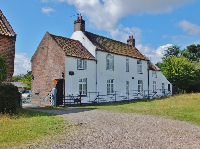
Lowson's Mill, or Westwood Mill, is first mentioned in 1802 when George Jakeman was permitted to have a cart-road (extant today) from Keldgate Road to the windmill he had erected in his close, adjoining but not actually part of the Westwood. It was a brick tower mill with five sails. The mill was dismantled in 1891 and today only the lower part of the tower remains. The white-painted buildings, originally part of the same close, are today semi-detached houses, being Westwood Mill and Westwood Mill Cottage respectively.
 Map © Crown Copyright")
TIP: Click the map for more Large scale mapping
- Grid Square
- TA0238, 163 images (more nearby 🔍)
- Photographer
- Bernard Sharp (more nearby)
- Date Taken
- Wednesday, 3 August, 2016 (more nearby)
- Submitted
- Friday, 5 August, 2016
- Subject Location
-
OSGB36:
 TA 0270 3863 [10m precision]
WGS84: 53:50.0272N 0:26.4556W - Camera Location
-
OSGB36: TA 0273 3864
- View Direction
- West-southwest (about 247 degrees)