2016
SN4120 : The former Carmarthen Infirmary, long derelict, now being redeveloped
taken 8 years ago, near to Carmarthen/Caerfyrddin, Carmarthenshire/Sir Gaerfyrddin, Wales
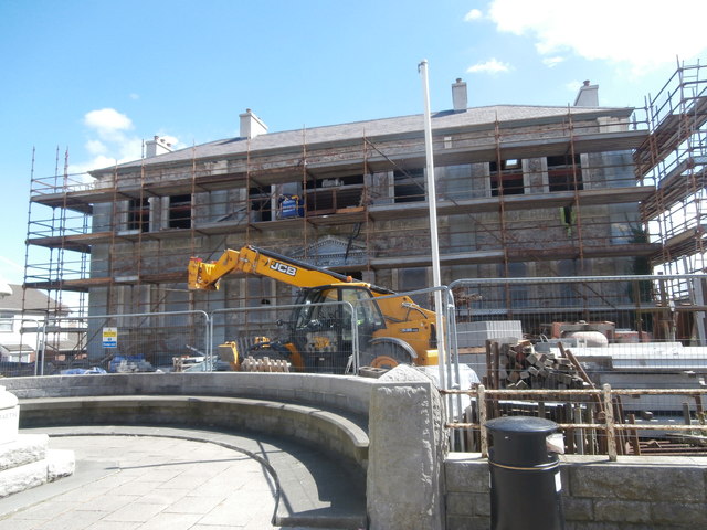
The former Carmarthen Infirmary, long derelict, now being redeveloped
 Map © Crown Copyright")
TIP: Click the map for more Large scale mapping
- Grid Square
- SN4120, 453 images (more nearby 🔍)
- Photographer
- John Lord (more nearby)
- Date Taken
- Monday, 8 August, 2016 (more nearby)
- Submitted
- Monday, 15 August, 2016
- Subject Location
-
OSGB36:
 SN 4165 2028 [10m precision]
WGS84: 51:51.5146N 4:18.0513W - Camera Location
-
OSGB36: SN 4162 2030
- View Direction
- East-southeast (about 112 degrees)