2016
TQ5660 : Footpath near Woodlands
taken 8 years ago, near to Heaverham, Kent, England
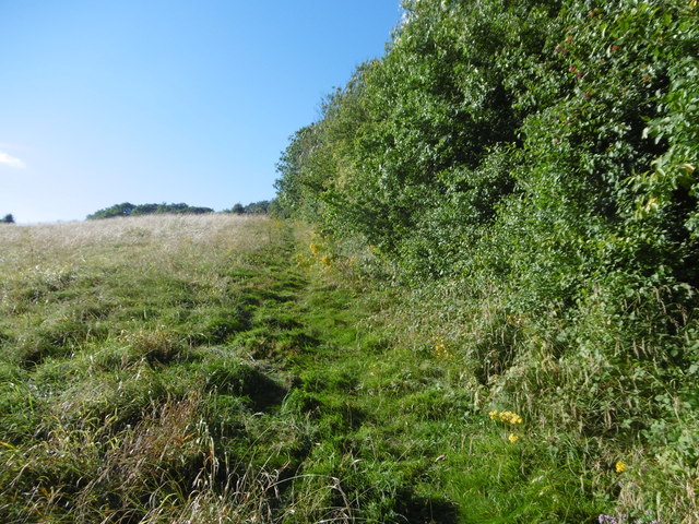
Footpath near Woodlands
Pevsner states it well: "At the furthest end of Knatts Valley in a position that is still amazingly remote, Talbot Bury built in 1851-2 what was to be the nucleus of a new parish of Woodlands, i.e. church, school and vicarage, all three with bell-gables, the school mimicking the shape of the church. Major Vincent, a surgeon at Guy's Hospital, paid for the church."
It is still remote and it is quite a surprise in these hills and valleys with their quiet lanes to suddenly come across the church and newly-restored hall next door. The church now comes under the parish of Kemsing. This view is looking up a footpath leading from the valley to eventually cross Woodlands Manor Golf Course and reach Hills Lane.
It is still remote and it is quite a surprise in these hills and valleys with their quiet lanes to suddenly come across the church and newly-restored hall next door. The church now comes under the parish of Kemsing. This view is looking up a footpath leading from the valley to eventually cross Woodlands Manor Golf Course and reach Hills Lane.
 Map © Crown Copyright")
TIP: Click the map for more Large scale mapping
- Grid Square
- TQ5660, 34 images (more nearby 🔍)
- Photographer
- Marathon (more nearby)
- Date Taken
- Monday, 22 August, 2016 (more nearby)
- Submitted
- Tuesday, 23 August, 2016
- Subject Location
-
OSGB36:
 TQ 5635 6075 [10m precision]
WGS84: 51:19.4620N 0:14.5517E - Camera Location
-
OSGB36: TQ 5641 6070
- View Direction
- Northwest (about 315 degrees)