2016
SE0298 : Stone Avenue, Maiden Castle
taken 8 years ago, near to Healaugh, North Yorkshire, England
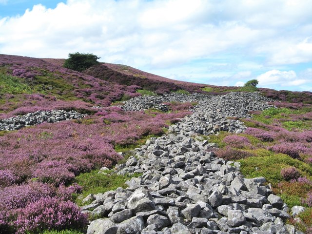
Stone Avenue, Maiden Castle
Looking west along the stone avenue towards the main site with the south side ditch and rampart heading left towards the nearer hawthorn tree. The whole site is dated as Iron Age, but there appears to have been insufficient archaeological work done to date the site more accurately. One speculates as to whether this was a Brigantian fort which may have controlled mid Swaledale, but did this place see any action when the Romans arrived?
 Map © Crown Copyright")
TIP: Click the map for more Large scale mapping
- Grid Square
- SE0298, 77 images (more nearby 🔍)
- Photographer
- Gordon Hatton (more nearby)
- Date Taken
- Wednesday, 24 August, 2016 (more nearby)
- Submitted
- Wednesday, 24 August, 2016
- Subject Location
-
OSGB36:
 SE 0227 9811 [10m precision]
WGS84: 54:22.7091N 1:57.9935W - Camera Location
-
OSGB36: SE 0229 9811
- View Direction
- WEST (about 270 degrees)