2015
SE2519 : Calder and Hebble Navigations Long Cut - Savile Town Locks
taken 9 years ago, near to Thornhill Edge, Kirklees, England
This is 1 of 6 images, with title starting with Calder and Hebble in this square
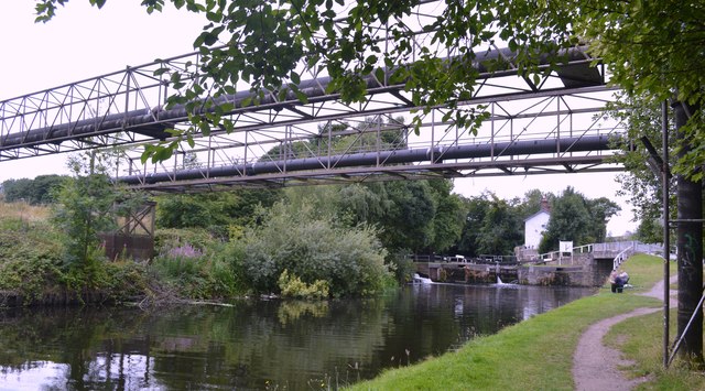
Calder and Hebble Navigations Long Cut - Savile Town Locks
These two pipe ranges cross the navigation a short distance to the south of Savile Town Locks. In the background is the entrance to the Dewsbury Arm.
 Map © Crown Copyright")
TIP: Click the map for more Large scale mapping
- Grid Square
- SE2519, 76 images (more nearby 🔍)
- Photographer
- Bobby Clegg (more nearby)
- Date Taken
- Tuesday, 11 August, 2015 (more nearby)
- Submitted
- Wednesday, 31 August, 2016
- Subject Location
-
OSGB36:
 SE 2509 1979 [10m precision]
WGS84: 53:40.4390N 1:37.3010W - Camera Location
-
OSGB36: SE 2513 1978
- View Direction
- West-northwest (about 292 degrees)