2016
HP5704 : Westing Schoolhouse and the Broch of Underhoull from Erns Hamar
taken 8 years ago, near to Underhoull, Unst, Shetland Islands, Scotland
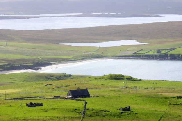
Westing Schoolhouse and the Broch of Underhoull from Erns Hamar
Lunda Wick and Loch of Vigga beyond.
 Map © Crown Copyright")
TIP: Click the map for more Large scale mapping
- Grid Square
- HP5704, 131 images (more nearby 🔍)
- Photographer
- Mike Pennington (more nearby)
- Date Taken
- Saturday, 3 September, 2016 (more nearby)
- Submitted
- Saturday, 3 September, 2016
- Subject Location
-
OSGB36:
 HP 5757 0447 [10m precision]
WGS84: 60:43.1526N 0:56.8034W - Camera Location
-
OSGB36: HP 5811 0487
- View Direction
- Southwest (about 225 degrees)