2016
SJ1116 : Moel Llaethbwlch
taken 8 years ago, near to Tycrwyn, Powys, Wales
This is 1 of 2 images, with title Moel Llaethbwlch in this square
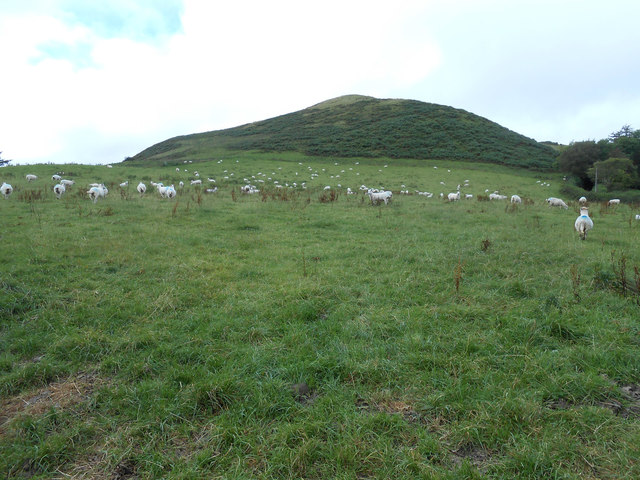
Moel Llaethbwlch
When I first glanced at the map, without my reading glasses, I read it as Moel Llaethbuwch. This as a name far more prosaic in that it would have meant Milky Cow Hill. Milk Pass Hill a good second place. This hill at 1,190ft stands proud of the many local bumps. Strangely, there is a spot height of 348 metres slightly northwest and below the summit.
 Map © Crown Copyright")
TIP: Click the map for more Large scale mapping
- Grid Square
- SJ1116, 4 images (more nearby 🔍)
- Photographer
- Martin Evans (more nearby)
- Date Taken
- Monday, 5 September, 2016 (more nearby)
- Submitted
- Monday, 5 September, 2016
- Subject Location
-
OSGB36:
 SJ 1132 1672 [10m precision]
WGS84: 52:44.4484N 3:18.8990W - Camera Location
-
OSGB36: SJ 1163 1669
- View Direction
- WEST (about 270 degrees)