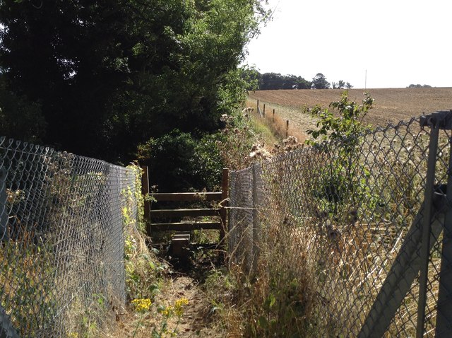
TR3448 : Hangman's Lane railway crossing: east side ramp
taken 8 years ago, near to Ringwould, Kent, England
Hangman's Lane is an old road out of Ringwould in the direction of Winkland Oaks. It survives as a now residential street in Ringwould, leading south-west off the junction of Front Street with Sutton Lane, but beyond, heads west-southwest across an arable field towards Ringwould Road, at a dogleg in that road which probably arose because Ringwould Road postdates Hangman's Lane. Perhaps this section of Hangman's Lane was once enclosed, but for at least the last two centuries, it has been a field road or path, now public bridleway ER16.
North of Ringwould Road, Hangman's Lane remains an enclosed, narrow lane, currently quite overgrown, but recorded as only a public footpath EE451. This section was formerly the parish boundary between Waldershare and a detached portion of Sutton. The Lane continues across the railway at a foot crossing, and remains enclosed for a short distance beyond. It then opens out on the north side and continues due west, as a headland path, and then projects across the arable field to the Martin to Sutton road opposite the entrance to Winkland Oaks Farm. It is not clear whether Hangman's Lane, as a named road, continued west into Langdon, or south-west to Appleton Farm, or into Winkland Oaks Farm, but it seems that the unmade road beyond the farm and north to Dover Hill, Sutton (now public footpath EE427) is of comparatively recent origin. There is another Hangman's Lane in Guston, and it is possible that both are the same lane, which once followed a now abandoned course just south of Langdon Abbey but north of Martin and East Langdon, and across Enifer Down, a route which can still be traced on the first edition twenty-five inch Ordnance Survey map.
 Map © Crown Copyright")
- Grid Square
- TR3448, 28 images (more nearby 🔍)
- Photographer
- Hugh Craddock (more nearby)
- Date Taken
- Saturday, 3 September, 2016 (more nearby)
- Submitted
- Friday, 9 September, 2016
- Subject Location
-
OSGB36:
 TR 3494 4806 [10m precision]
WGS84: 51:11.0076N 1:21.6228E - Camera Location
-
OSGB36: TR 3493 4807
- View Direction
- Southeast (about 135 degrees)