2016
SP0288 : Smethwick Locks - Top Lock
taken 8 years ago, near to Smethwick, Sandwell, England
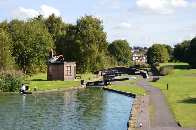
Smethwick Locks - Top Lock
Smeaton's alignment of 1789 replaced and lowered the summit of a 1000yard section of Brindley's 1778 canal allowing three locks to be removed at each end and conserving water. Duplicate locks were provided on either side of the tollhouse to speed passage.
 Map © Crown Copyright")
TIP: Click the map for more Large scale mapping
- Grid Square
- SP0288, 174 images (more nearby 🔍)
- Photographer
- John M (more nearby)
- Date Taken
- Sunday, 11 September, 2016 (more nearby)
- Submitted
- Sunday, 11 September, 2016
- Subject Location
-
OSGB36:
 SP 024 889 [100m precision]
WGS84: 52:29.9070N 1:57.9646W - Camera Location
-
OSGB36: SP 023 889
- View Direction
- Northeast (about 45 degrees)