2016
NF7921 : Loch nan Smalag - water for Lochboisdale
taken 8 years ago, near to Lochboisdale/Loch Baghasdail, South Uist & Benbecula, Na h-Eileanan an Iar, Scotland
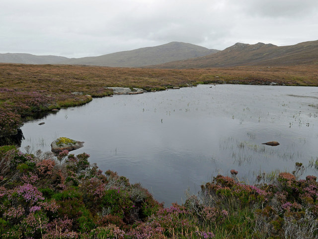
Loch nan Smalag - water for Lochboisdale
Essentially a loch in two sections with a minor stream to cross between them. This is the much smaller part. The loch is dammed and appears to be the water supply for Lochboisdale. The distant hill is Stulabhal.
 Map © Crown Copyright")
TIP: Click the map for more Large scale mapping
- Grid Square
- NF7921, 2 images (more nearby 🔍)
- Photographer
- Julian Paren (more nearby)
- Date Taken
- Sunday, 11 September, 2016 (more nearby)
- Submitted
- Tuesday, 13 September, 2016
- Subject Location
-
OSGB36:
 NF 798 210 [100m precision]
WGS84: 57:10.1082N 7:17.8814W - Camera Location
-
OSGB36: NF 798 210
- View Direction
- NORTH (about 0 degrees)