2016
SN6804 : Ordnance Survey Cut Mark
taken 8 years ago, 3 km from Craig-Cefn-Parc, Swansea/Abertawe, Wales
This is 1 of 3 images, with title Ordnance Survey Cut Mark in this square
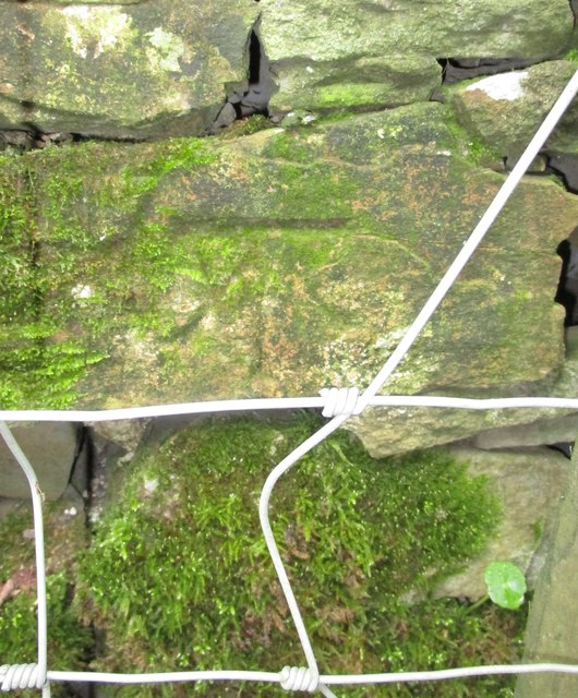
Ordnance Survey Cut Mark
This OS cut mark can be found on the wall on the NE side of the road. It marks a point 192.789m above mean sea level.
 Map © Crown Copyright")
TIP: Click the map for more Large scale mapping
- Grid Square
- SN6804, 14 images (more nearby 🔍)
- Photographer
- Adrian Dust (more nearby)
- Date Taken
- Monday, 19 September, 2016 (more nearby)
- Submitted
- Monday, 19 September, 2016
- Subject Location
-
OSGB36:
 SN 6820 0496 [10m precision]
WGS84: 51:43.6691N 3:54.5846W - Camera Location
-
OSGB36: SN 6820 0496
- View Direction
- East-northeast (about 67 degrees)