1967
NF0998 : Hirta and Dun, St Kilda
taken 57 years ago, near to Ruabha [other Features], Na h-Eileanan an Iar, Great Britain
Hirta and Dun, St Kilda
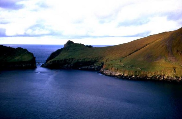
Ruaival and Dun from the slopes of Oiseval.
St Kilda, 1967
These photos are a record from a two-week visit to St Kilda in September 1967, so their quality is not of the best as they were scanned from transparencies or prints of the time. It was an interesting expedition for two mycologists from Edinburgh, arranged through the auspices of the Nature Conservancy [Scotland], to record the fungi of the islands. We travelled courtesy the army's Royal Corps of Transport on their fortnightly tank landing craft service, and stayed in the Factor's House.
 Map © Crown Copyright")
TIP: Click the map for more Large scale mapping
- Grid Square
- NF0998, 33 images (more nearby 🔍)
- Photographer
- M J Richardson (more nearby)
- Date Taken
- September 1967 (more nearby)
- Submitted
- Wednesday, 1 August, 2007
- Subject Location
-
OSGB36:
 NF 096 982 [100m precision]
WGS84: 57:48.1569N 8:34.5710W - Camera Location
-
OSGB36: NF 108 989
- View Direction
- West-southwest (about 247 degrees)