2016
HT9736 : Garmin navigation display
taken 8 years ago, near to Foula Airstrip, Foula, Shetland Islands, Scotland
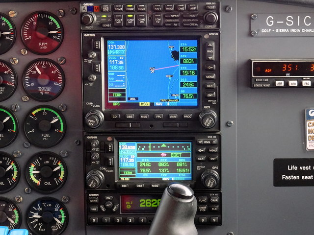
Garmin navigation display
On a Britten-Norman Islander flight from Foula to Tingwall.
 Map © Crown Copyright")
TIP: Click the map for more Large scale mapping
- Grid Square
- HT9736, 5 images (more nearby 🔍)
- Photographer
- John Lucas (more nearby)
- Date Taken
- Tuesday, 20 September, 2016 (more nearby)
- Submitted
- Sunday, 25 September, 2016
- Subject Location
-
OSGB36:
 HT 9723 3684 [10m precision]
WGS84: 60:6.9675N 2:3.0983W - Camera Location
-
OSGB36: HT 9723 3684
- View Direction
- South-southeast (about 157 degrees)