2016
SE0214 : Erosion of peat on Deanhead Moor, Scammonden
taken 8 years ago, near to Booth Wood, Calderdale, England
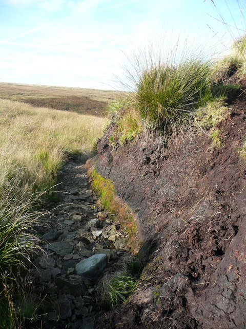
Erosion of peat on Deanhead Moor, Scammonden
This is at the edge of a little valley, the one shown in SE0214 : Minor clough on Deanhead Moor, Scammonden. It seems that the flow of water after heavy rain keeps to the edge and has eroded the peat down to a layer of stones. The peat was about two metres deep where I was standing.
 Map © Crown Copyright")
TIP: Click the map for more Large scale mapping
- Grid Square
- SE0214, 42 images (more nearby 🔍)
- Photographer
- Humphrey Bolton (more nearby)
- Date Taken
- Thursday, 22 September, 2016 (more nearby)
- Submitted
- Sunday, 25 September, 2016
- Subject Location
-
OSGB36:
 SE 0276 1458 [10m precision]
WGS84: 53:37.6647N 1:57.5845W - Camera Location
-
OSGB36: SE 0276 1458
- View Direction
- NORTH (about 0 degrees)