2016
TQ5335 : Harrison's Rocks
taken 8 years ago, near to Groombridge, East Sussex, England
This is 1 of 23 images, with title Harrison's Rocks in this square
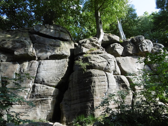
Harrison's Rocks
Harrison's Rocks were formed approximately 135 million years ago of the Tunbridge Wells Sand Formation during the early Cretaceous period. Harrison's Rocks are owned and managed by the British Mountaineering Council. Their website can be seen at Link
Birchden Wood is behind and comes up to the edge of the rock formations.
Birchden Wood is behind and comes up to the edge of the rock formations.
 Map © Crown Copyright")
TIP: Click the map for more Large scale mapping
- Grid Square
- TQ5335, 154 images (more nearby 🔍)
- Photographer
- Marathon (more nearby)
- Date Taken
- Sunday, 25 September, 2016 (more nearby)
- Submitted
- Tuesday, 27 September, 2016
- Subject Location
-
OSGB36:
 TQ 5324 3565 [10m precision]
WGS84: 51:5.9809N 0:11.2329E - Camera Location
-
OSGB36: TQ 5324 3567
- View Direction
- SOUTH (about 180 degrees)