2007
SD9321 : Pennine Bridleway, North Hollingworth
taken 17 years ago, near to Walsden, Calderdale, England
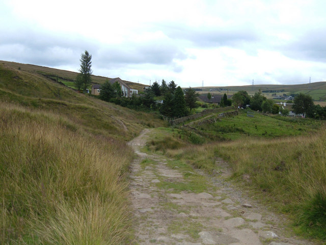
Pennine Bridleway, North Hollingworth
Looking south along the line of the National Trail towards North Hollingworth Farm. This is part of the Mary Towneley Loop section of the Pennine Bridleway about 500 metres to the east of the village of Walsden.
 Map © Crown Copyright")
TIP: Click the map for more Large scale mapping
- Grid Square
- SD9321, 246 images (more nearby 🔍)
- Photographer
- michael ely (more nearby)
- Date Taken
- Thursday, 2 August, 2007 (more nearby)
- Submitted
- Thursday, 2 August, 2007
- Subject Location
-
OSGB36:
 SD 939 218 [100m precision]
WGS84: 53:41.5566N 2:5.5586W - Camera Location
-
OSGB36: SD 939 218
- View Direction
- SOUTH (about 180 degrees)