2007
NT2975 : Footpath
taken 17 years ago, near to Leith, Edinburgh, Scotland
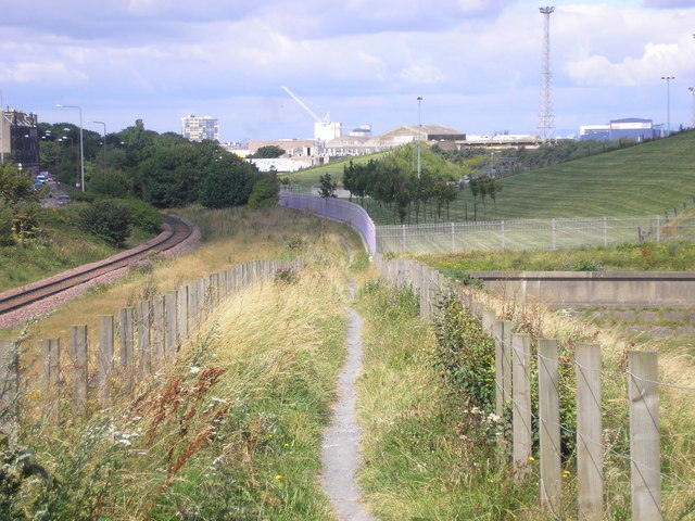
Footpath
The view of the footpath between the railway line (on the left) and the sewage works (on the right). Buildings at Leith Docks can be seen in the distance on the right.
In the foreground on the right is the start of the new sea wall which was built when the ground on what is now the sewage works was reclaimed from the sea NT2975 : Seafield..
In the foreground on the right is the start of the new sea wall which was built when the ground on what is now the sewage works was reclaimed from the sea NT2975 : Seafield..
 Map © Crown Copyright")
TIP: Click the map for more Large scale mapping
- Grid Square
- NT2975, 61 images (more nearby 🔍)
- Photographer
- Sandy Gemmill (more nearby)
- Date Taken
- Thursday, 2 August, 2007 (more nearby)
- Submitted
- Thursday, 2 August, 2007
- Subject Location
-
OSGB36:
 NT 290 756 [100m precision]
WGS84: 55:58.0879N 3:8.3426W - Camera Location
-
OSGB36: NT 290 756
- View Direction
- West-northwest (about 292 degrees)