2007
TF3812 : Bridleway alongside Lady Nunn's Old Eau
taken 17 years ago, near to Sutton st Edmund, Lincolnshire, England
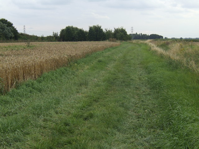
Bridleway alongside Lady Nunn's Old Eau
Approaching a small patch of woodland; the path follows the field edge as opposed to cutting across the wheat field on the left, as indicated by the OS.
 Map © Crown Copyright")
TIP: Click the map for more Large scale mapping
- Grid Square
- TF3812, 3 images (more nearby 🔍)
- Photographer
- Jonathan Billinger (more nearby)
- Date Taken
- Thursday, 2 August, 2007 (more nearby)
- Submitted
- Thursday, 2 August, 2007
- Subject Location
-
OSGB36:
 TF 382 128 [100m precision]
WGS84: 52:41.7460N 0:2.6939E - Camera Location
-
OSGB36: TF 383 129
- View Direction
- SOUTH (about 180 degrees)