2016
SJ8297 : Ordsall Chord
taken 8 years ago, near to Rusholme, Manchester, England
This is 1 of 10 images, with title Ordsall Chord in this square
Ordsall Chord
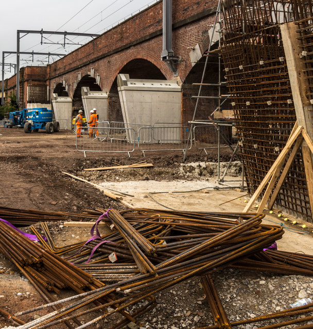
Works for the Ordsall Chord rail link.
The Ordsall Chord
The Ordsall Chord (also known as the Ordsall Lane Chord, Ordsall Curve or Castlefield Curve) is a short stretch of railway line currently (2016/17) under construction in the Ordsall area of Salford. It will link the mainline railway stations at Manchester Piccadilly and Manchester Victoria.
First proposed in the 1970s (as the "Castlefield Curve"), parliamentary powers for construction of the link were received in 1979 but the project was cancelled. The proposal was revived in 2010 as part of Network Rails Manchester Northern Hub proposal. It is scheduled to be completed by December 2017, and will cost around £85 million to construct.
 Map © Crown Copyright")
TIP: Click the map for more Large scale mapping
- Grid Square
- SJ8297, 472 images (more nearby 🔍)
- Photographer
- Peter McDermott (more nearby)
- Date Taken
- Saturday, 1 October, 2016 (more nearby)
- Submitted
- Saturday, 1 October, 2016
- Subject Location
-
OSGB36:
 SJ 8286 9787 [10m precision]
WGS84: 53:28.6364N 2:15.5831W - Camera Location
-
OSGB36: SJ 82871 97852
- View Direction
- North-northwest (about 337 degrees)