2016
TQ3281 : Parish boundary markers, Cheapside
taken 8 years ago, near to City of London, The City of London, England
This is 1 of 3 images, with title Parish boundary markers, Cheapside in this square
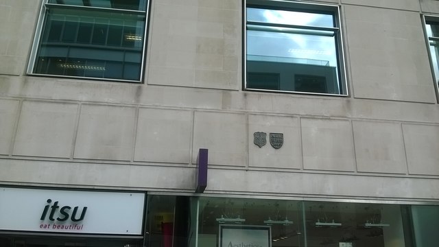
Parish boundary markers, Cheapside
These mark the division between two of the City's ancient parishes: St Mary Magdalen Milk Street to the left (west) and All Hallows Honey Lane to the right (east). Neither church now survives.
 Map © Crown Copyright")
TIP: Click the map for more Large scale mapping
- Grid Square
- TQ3281, 5802 images (more nearby 🔍)
- Photographer
- Christopher Hilton (more nearby)
- Date Taken
- Wednesday, 28 September, 2016 (more nearby)
- Submitted
- Sunday, 2 October, 2016
- Subject Location
-
OSGB36:
 TQ 3236 8119 [10m precision]
WGS84: 51:30.8482N 0:5.6355W - Camera Location
-
OSGB36: TQ 3236 8119
- View Direction
- North-northeast (about 22 degrees)