SJ8748 : Cycleway on Central Forest Park
taken 8 years ago, near to Hanley, Stoke-on-Trent, England
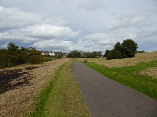
Central Forest Park is in Hanley, and is composed of colliery spoil tips which have now been landscaped and reclaimed. It covers 49 hectares principally of grassland and scrub, with a lake. Amenities include picnic area, skate park, and a safari-themed adventure play area. The park is crossed by two national cycle routes (5 and 55) and the Burslem-Cobridge greenway.
The National Cycle Network is a network of cycle routes. It was created by the charity Sustrans Link
(Sustainable Transport), aided by a National Lottery grant.
Many routes aim to minimise contact with motor traffic, though 70% of them are on roads. In some cases the NCN uses pedestrian routes, disused railways, minor roads, canal towpaths, or traffic-calmed routes in towns and cities.
National Route 5 of the National Cycle Network is a long distance route which when complete will connect Reading and Holyhead via Oxford, Banbury, Stratford-upon-Avon, Redditch, Bromsgrove, Birmingham, Walsall, Stafford, Stoke-on-Trent, Chester, Colwyn Bay and Bangor. The southern half of the route between Reading and Walsall is open and signed whilst the northern half between Walsall and Holyhead is still under development.
 Map © Crown Copyright")
- Grid Square
- SJ8748, 90 images (more nearby 🔍)
- Photographer
- Jonathan Hutchins (more nearby)
- Date Taken
- Saturday, 24 September, 2016 (more nearby)
- Submitted
- Tuesday, 4 October, 2016
- Subject Location
-
OSGB36:
 SJ 8793 4862 [10m precision]
WGS84: 53:2.0832N 2:10.8865W - Camera Location
-
OSGB36: SJ 87942 48595
- View Direction
- North-northwest (about 337 degrees)