2016
TQ2105 : Shoreham-by-Sea Snooker Club, West Street
taken 8 years ago, near to Shoreham-by-Sea, West Sussex, England
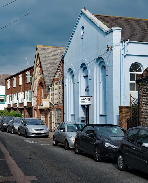
Shoreham-by-Sea Snooker Club, West Street
"This Classical-style chapel was opened in 1862 for the Primitive Methodist community. When a new chapel opened in 1879, it became a Salvation Army hall. Since the 1930s it has been home to the Shoreham Snooker Club." - Quotation from this Link .
.
 Map © Crown Copyright")
TIP: Click the map for more Large scale mapping
- Grid Square
- TQ2105, 463 images (more nearby 🔍)
- Photographer
- Jim Osley (more nearby)
- Date Taken
- Friday, 7 October, 2016 (more nearby)
- Submitted
- Sunday, 9 October, 2016
- Subject Location
-
OSGB36:
 TQ 2139 0514 [10m precision]
WGS84: 50:49.9844N 0:16.6556W - Camera Location
-
OSGB36: TQ 2136 0512
- View Direction
- East-northeast (about 67 degrees)