2016
R4897 : Owendalulleagh River
taken 8 years ago, 4 km NW of Drumandoora, Co Clare, Ireland
Owendalulleagh River
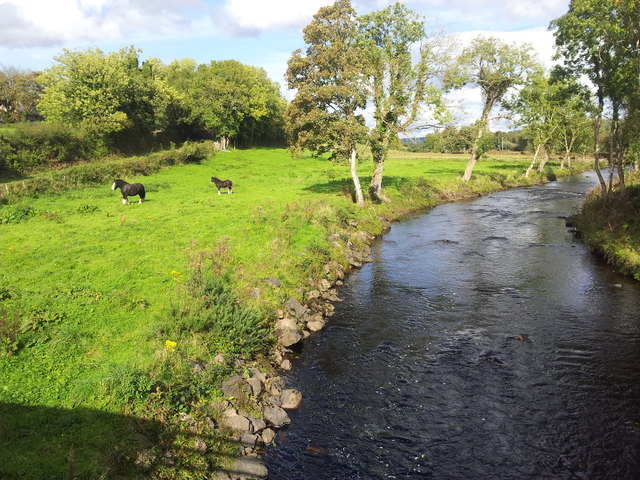
This image was taken from a bridge over the river Owendalulleagh, near Gort in south County Galway. A sign beside the bridge indicates that this is the beginning of the Kilbeacanty "golden mile." The road here forms part of the "Lough Cutra Drive." The name of the river translates from the Irish as "river of the two milch cows."
Loading map... (JavaScript required)
- Grid Square
- R4897, 2 images (more nearby 🔍)
- Photographer
- DeeEmm (more nearby)
- Date Taken
- Sunday, 2 October, 2016 (more nearby)
- Submitted
- Wednesday, 12 October, 2016
- Subject Location
-
Irish:
 R 484 972 [100m precision]
WGS84: 53:1.4257N 8:46.1558W - Camera Location
-
Irish: R 484 972
- View Direction
- North-northeast (about 22 degrees)