2016
TF2582 : RAF Stenigot
taken 7 years ago, near to Stenigot, Lincolnshire, England
This is 1 of 2 images, with title starting with RAF Stenigot in this square
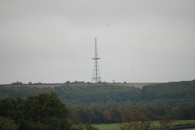
RAF Stenigot
The last surviving Chain Home radar tower from WW2.
As seen from the same location as TF2479 : The valley of the Bain
As seen from the same location as TF2479 : The valley of the Bain
 Map © Crown Copyright")
TIP: Click the map for more Large scale mapping
- Grid Square
- TF2582, 45 images (more nearby 🔍)
- Photographer
- Bob Harvey (more nearby)
- Date Taken
- Wednesday, 19 October, 2016 (more nearby)
- Submitted
- Friday, 21 October, 2016
- Subject Location
-
OSGB36:
 TF 256 825 [100m precision]
WGS84: 53:19.4976N 0:6.8782W - Camera Location
-
OSGB36: TF 239 790
- View Direction
- North-northeast (about 22 degrees)