2016
NY4028 : Junction of cycleways
taken 7 years ago, near to Berrier, Cumbria, England
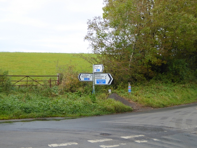
Junction of cycleways
National Cycle Network route 71 (the world-famous C2C) turns here, but an alternative route keeps straight on to Berrier.
 Map © Crown Copyright")
TIP: Click the map for more Large scale mapping
- Grid Square
- NY4028, 16 images (more nearby 🔍)
- Photographer
- Oliver Dixon (more nearby)
- Date Taken
- Friday, 21 October, 2016 (more nearby)
- Submitted
- Sunday, 23 October, 2016
- Subject Location
-
OSGB36:
 NY 4044 2897 [10m precision]
WGS84: 54:39.1376N 2:55.4772W - Camera Location
-
OSGB36: NY 40464 28970
- View Direction
- WEST (about 270 degrees)