TQ5646 : Leigh Flood Barrier
taken 8 years ago, near to Leigh, Kent, England
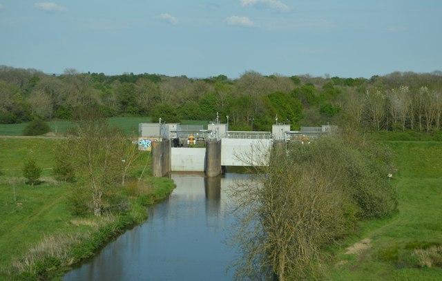
Built in 1981, the flood barrier was constructed near Leigh to protect Tonbridge, which had been severely affected by the flooding of 1968. During periods of high flow, the downstream flow is controlled by allowing up to 1 square mile (2.6 km2) of farmland upstream of the barrier to flood. This is an in-line storage scheme. An embankment has been built across the Medway valley to hold back the water.
The River Medway is 70 miles long and flows almost entirely within Kent. It rises in Ashdown Forest and joins the Thames near Chatham. Apart from the Thames it has the largest catchment area in southern England. The river is navigable as far as Tonbridge by large craft and as far as Penshurst by small craft. There are 11 locks on the river, between Allington and Tonbridge. The river is tidal to Allington Lock. The River divides Kent in two, those born west of the river are known as Kentish Men, whilst those born east of the river are Men of Kent. The river was used as a line of defence against possible invasion during WWII.
 Map © Crown Copyright")
- Grid Square
- TQ5646, 320 images (more nearby 🔍)
- Photographer
- N Chadwick (more nearby)
- Date Taken
- Sunday, 8 May, 2016 (more nearby)
- Submitted
- Monday, 31 October, 2016
- Subject Location
-
OSGB36:
 TQ 5637 4611 [10m precision]
WGS84: 51:11.5693N 0:14.1852E - Camera Location
-
OSGB36: TQ 5618 4613
- View Direction
- EAST (about 90 degrees)