2007
SU2335 : Track on Easton Down
taken 17 years ago, near to Lopcombe Corner, Wiltshire, England
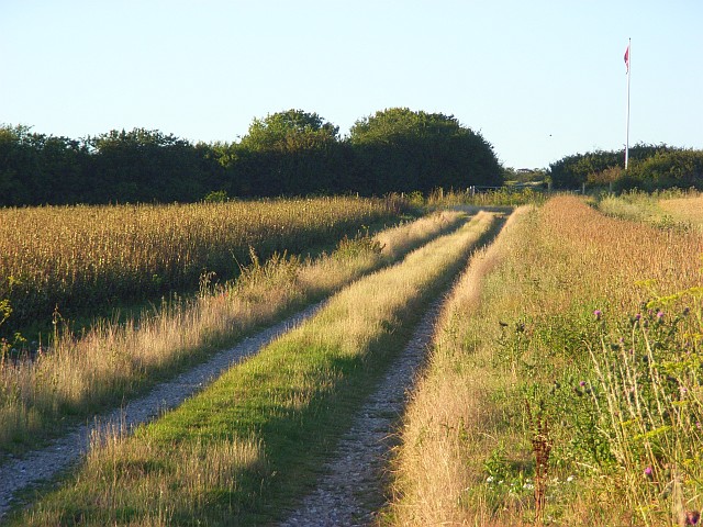
Track on Easton Down
Still marked on maps as a public byway though there is now no public access due to the byelaws that have closed Porton Down. There is some farmland within the MOD land. The track crosses between arable fields before reaching the flagpole that signifies the start of the danger zone.
 Map © Crown Copyright")
TIP: Click the map for more Large scale mapping
- Grid Square
- SU2335, 2 images (more nearby 🔍)
- Photographer
- Andrew Smith (more nearby)
- Date Taken
- Saturday, 4 August, 2007 (more nearby)
- Submitted
- Monday, 6 August, 2007
- Subject Location
-
OSGB36:
 SU 236 353 [100m precision]
WGS84: 51:6.9905N 1:39.8529W - Camera Location
-
OSGB36: SU 235 350
- View Direction
- North-northeast (about 22 degrees)