2016
NS2377 : Cairn on Tower Hill
taken 8 years ago, near to Gourock, Inverclyde, Scotland
This is 1 of 2 images, with title Cairn on Tower Hill in this square
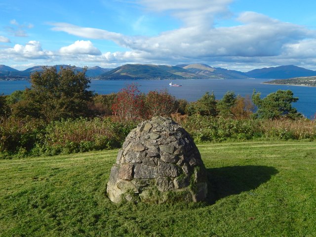
Cairn on Tower Hill
The cairn is shown from the other side in a picture of NS2377 : The tower on Tower Hill; its original use is pointed out there. For support of this idea, see NS2377 : Cairn on Tower Hill, showing what is inside.
In the present picture, the hills directly behind the cairn range from the summit at NS183821 (near Kilmun and Strone Point), behind the left-hand edge of the cairn, to NS171863 (Stronchullin Hill), behind its right-hand edge.
In the present picture, the hills directly behind the cairn range from the summit at NS183821 (near Kilmun and Strone Point), behind the left-hand edge of the cairn, to NS171863 (Stronchullin Hill), behind its right-hand edge.
The tower on Tower Hill, Gourock
The hill itself is named Drumshantie Hill on the first-edition OS map (surveyed in 1857); the 1897 revision of the map uses the name Tower Hill, as do subsequent editions.
An entry in the OS Name Books of c.1856 names the builder of the tower: "Drumshantie Hill a hill of considerable elevation on the estate of Gourock, near the village. On the highest part there is a tower, built by the late General Darroch, from which the view obtained of the firth and surrounding scenery is very extensive".
The same Darroch family occupied Gourock House Link (now gone), in what is now Gourock Park (or Darroch Park). They are also commemorated in the Darroch Vault Link which lies in the park.
 Map © Crown Copyright")
TIP: Click the map for more Large scale mapping
- Grid Square
- NS2377, 361 images (more nearby 🔍)
- Photographer
- Lairich Rig (more nearby)
- Date Taken
- Monday, 10 October, 2016 (more nearby)
- Submitted
- Wednesday, 9 November, 2016
- Subject Location
-
OSGB36:
 NS 2389 7733 [10m precision]
WGS84: 55:57.3967N 4:49.3495W - Camera Location
-
OSGB36: NS 2389 7733
- View Direction
- Northwest (about 315 degrees)