2016
NS2577 : The Old Toll House
taken 8 years ago, near to Larkfield, Inverclyde, Scotland
This is 1 of 2 images, with title The Old Toll House in this square
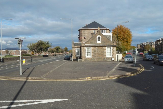
The Old Toll House
The building, located at the sharp end of a wedge of housing between Eldon Street (left) and Newark Street, is shown in two earlier pictures: NS2577 : The Old Toll House and NS2577 : Old Toll House, Eldon Street.
It dates from the early nineteenth century, and marked the boundary between Gourock (near side) and Greenock.
It dates from the early nineteenth century, and marked the boundary between Gourock (near side) and Greenock.
 Map © Crown Copyright")
TIP: Click the map for more Large scale mapping
- Grid Square
- NS2577, 363 images (more nearby 🔍)
- Photographer
- Lairich Rig (more nearby)
- Date Taken
- Monday, 10 October, 2016 (more nearby)
- Submitted
- Thursday, 10 November, 2016
- Subject Location
-
OSGB36:
 NS 2540 7750 [10m precision]
WGS84: 55:57.5213N 4:47.9068W - Camera Location
-
OSGB36: NS 2538 7747
- View Direction
- Northeast (about 45 degrees)