2016
NU0050 : Ordnance Survey Flush Bracket G2712
taken 8 years ago, near to Scremerston, Northumberland, England
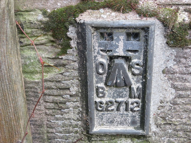
Ordnance Survey Flush Bracket G2712
This can be found on the wall of a house - a private dwelling - on the A1167 road near Scremerston. Formerly the Miners Arms PH.
 Map © Crown Copyright")
TIP: Click the map for more Large scale mapping
- Grid Square
- NU0050, 56 images (more nearby 🔍)
- Photographer
- Peter Wood (more nearby)
- Date Taken
- Tuesday, 4 October, 2016 (more nearby)
- Submitted
- Saturday, 12 November, 2016
- Subject Location
-
OSGB36:
 NU 00197 50353 [1m precision]
WGS84: 55:44.7933N 1:59.9057W