2016
NS8534 : Arable Land Near Rigside
taken 7 years ago, near to Happendon, South Lanarkshire, Scotland
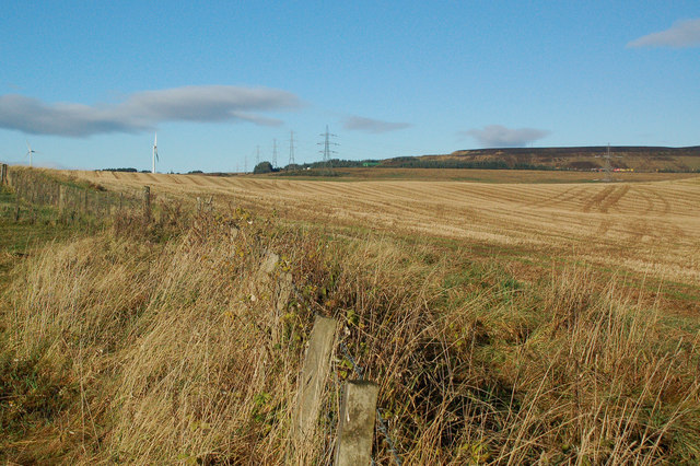
Arable Land Near Rigside
A harvested cereal field in the valley of the Douglas Water, viewed in mid-November.
 Map © Crown Copyright")
TIP: Click the map for more Large scale mapping
- Grid Square
- NS8534, 16 images (more nearby 🔍)
- Photographer
- Mary and Angus Hogg (more nearby)
- Date Taken
- Thursday, 10 November, 2016 (more nearby)
- Submitted
- Saturday, 12 November, 2016
- Subject Location
-
OSGB36:
 NS 8581 3494 [10m precision]
WGS84: 55:35.6791N 3:48.8165W - Camera Location
-
OSGB36: NS 8585 3489
- View Direction
- Northwest (about 315 degrees)