2016
NZ3655 : Cycle and foot-path at Grindon
taken 7 years ago, near to South Hylton, Sunderland, England
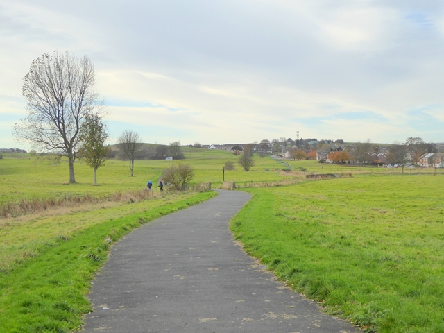
Cycle and foot-path at Grindon
Traversing a large area of open land which rises to Grindon Hill NZ3554 on the skyline. The Sunderland suburb of Grindon is off to the right.
 Map © Crown Copyright")
TIP: Click the map for more Large scale mapping
- Grid Square
- NZ3655, 32 images (more nearby 🔍)
- Photographer
- Oliver Dixon (more nearby)
- Date Taken
- Tuesday, 15 November, 2016 (more nearby)
- Submitted
- Wednesday, 16 November, 2016
- Subject Location
-
OSGB36:
 NZ 3643 5505 [10m precision]
WGS84: 54:53.3324N 1:26.0167W - Camera Location
-
OSGB36: NZ 36534 55116
- View Direction
- West-southwest (about 247 degrees)