2016
TQ4667 : Bridge Road
taken 8 years ago, near to St Mary Cray, Bromley, England
This is 1 of 2 images, with title Bridge Road in this square
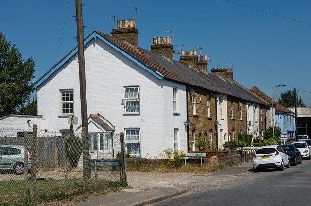
Bridge Road
Late Victorian terraced housing in the Fordcroft area of Poverest.
 Map © Crown Copyright")
TIP: Click the map for more Large scale mapping
- Grid Square
- TQ4667, 164 images (more nearby 🔍)
- Photographer
- Ian Capper (more nearby)
- Date Taken
- Wednesday, 17 August, 2016 (more nearby)
- Submitted
- Wednesday, 16 November, 2016
- Subject Location
-
OSGB36:
 TQ 467 675 [100m precision]
WGS84: 51:23.2689N 0:6.4726E - Camera Location
-
OSGB36: TQ 467 675
- View Direction
- North-northeast (about 22 degrees)