2016
SD4974 : Water worn limestone, Summerhouse Hill
taken 7 years ago, near to Yealand Conyers, Lancashire, England
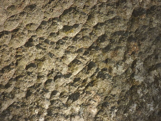
Water worn limestone, Summerhouse Hill
This highly scalloped surface on a boulder has been produced by hundreds of years of solutional weathering by very slightly acidic rainwater.
 Map © Crown Copyright")
TIP: Click the map for more Large scale mapping
- Grid Square
- SD4974, 54 images (more nearby 🔍)
- Photographer
- Karl and Ali (more nearby)
- Date Taken
- Sunday, 20 November, 2016 (more nearby)
- Submitted
- Wednesday, 23 November, 2016
- Subject Location
-
OSGB36:
 SD 4995 7437 [10m precision]
WGS84: 54:9.7609N 2:46.0810W - Camera Location
-
OSGB36: SD 4995 7437
- View Direction
- EAST (about 90 degrees)