2016

NZ0511 : Moor House Farm

taken 7 years ago, near to Scargill, County Durham, England
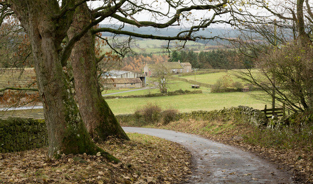
Moor House Farm
Moor House Farm
The road descends to reach and pass Moor House Farm continuing then to a dead end on the north side of the River Greta at Brignall Mill.

Creative Commons Licence [Some Rights Reserved]   © Copyright Trevor Littlewood and licensed for reuse under this Creative Commons Licence.
Geographical Context: Boundary, Barrier Farm, Fishery, Market Gardening Roads, Road transport Primary Subject: Farm other tags: Farm Road Farm Land Minor Road Dry Stone Walls Click a tag, to view other nearby images.
This photo is linked from: Articles: · Images shortlisted for POTY, 2016 Automatic Clusters: · River Greta at Brignall [4] · Continues [2] ·
1:50,000 Modern Day Landranger(TM) Map © Crown Copyright
+
+
1:50,000 Modern Day Landranger(TM) Map © Crown Copyright
TIP: Click the map for more Large scale mapping
Grid Square
NZ0511, 7 images   (more nearby 🔍)
Photographer
Trevor Littlewood   (more nearby)
Date Taken
Sunday, 27 November, 2016   (more nearby)
Submitted
Monday, 28 November, 2016
Subject Location
OSGB36: geotagged! NZ 0515 1153 [10m precision]
WGS84: 54:29.9442N 1:55.3196W
Camera Location
OSGB36: geotagged! NZ 0526 1176
View Direction
South-southwest (about 202 degrees)
Clickable map
+
NW N NE
W Go E
SW S SE
Image Type (about): geograph  (Fourth Visitor for NZ0511)
This page has been viewed about 60 times
You are not logged in login | register