2016
NJ1649 : Rothes II Wind Farm
taken 7 years ago, near to Burn of Corrhatnich [water Feature], Moray, Great Britain
This is 1 of 3 images, with title Rothes II Wind Farm in this square
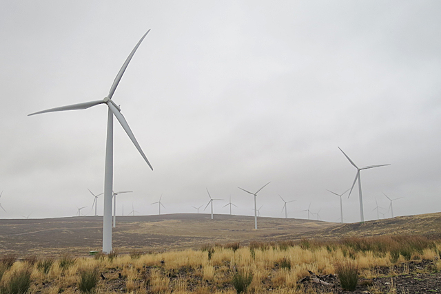
Rothes II Wind Farm
I think there are 23 turbines in this view. The nearer ones are part of the Rothes II wind farm, and the rest are part of Rothes I. See Link (Archive Link ) for information about Rothes II wind farm.
 Map © Crown Copyright")
TIP: Click the map for more Large scale mapping
- Grid Square
- NJ1649, 6 images (more nearby 🔍)
- Photographer
- Anne Burgess (more nearby)
- Date Taken
- Tuesday, 29 November, 2016 (more nearby)
- Submitted
- Tuesday, 29 November, 2016
- Subject Location
-
OSGB36:
 NJ 1695 4947 [10m precision]
WGS84: 57:31.6639N 3:23.3092W - Camera Location
-
OSGB36: NJ 1659 4941
- View Direction
- EAST (about 90 degrees)