2016
TQ4870 : Green Belt to the north of Maidstone Road
taken 7 years ago, near to Foots Cray, Bexley, England
This is 1 of 3 images, with title Green Belt to the north of Maidstone Road in this square
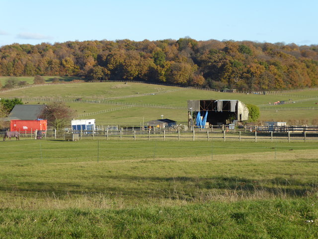
Green Belt to the north of Maidstone Road
This is the view from the edge of the built-up area alongside Maidstone Road, looking across Honeydale Farm to Chalk Wood. It is the typical 'horseyculture' seen around the Green Belt.
 Map © Crown Copyright")
TIP: Click the map for more Large scale mapping
- Grid Square
- TQ4870, 63 images (more nearby 🔍)
- Photographer
- Marathon (more nearby)
- Date Taken
- Monday, 28 November, 2016 (more nearby)
- Submitted
- Friday, 2 December, 2016
- Subject Location
-
OSGB36:
 TQ 4870 7055 [10m precision]
WGS84: 51:24.8684N 0:8.2150E - Camera Location
-
OSGB36: TQ 4856 7046
- View Direction
- Northeast (about 45 degrees)