2016
SK4764 : Rowthorne, Nr Glapwell, Derbyshire
taken 7 years ago, near to Rowthorne, Derbyshire, England
This is 1 of 6 images, with title Rowthorne, Nr Glapwell, Derbyshire. in this square
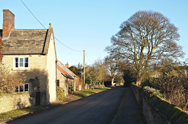
Rowthorne, Nr Glapwell, Derbyshire.
Part of the Pear Tree Farm farmhouse, with some of its farm buildings beyond. The farmhouse and some of its outbuildings and associated structures are Grade II-listed. The former school (1855-c.1950), now a private dwelling, is located beyond the large tree on the right. The larger, forming mining village of Glapwell lies 15-20 minutes ahead on foot.
 Map © Crown Copyright")
TIP: Click the map for more Large scale mapping
- Grid Square
- SK4764, 88 images (more nearby 🔍)
- Photographer
- David Hallam-Jones (more nearby)
- Date Taken
- Sunday, 4 December, 2016 (more nearby)
- Submitted
- Sunday, 4 December, 2016
- Subject Location
-
OSGB36:
 SK 4791 6499 [10m precision]
WGS84: 53:10.7918N 1:17.0754W - Camera Location
-
OSGB36: SK 4790 6498
- View Direction
- North-northeast (about 22 degrees)