2016
NS3582 : Forestry land on Darleith Muir
taken 7 years ago, 3 km from Arden, Argyll And Bute, Scotland
This is 1 of 2 images, with title Forestry land on Darleith Muir in this square
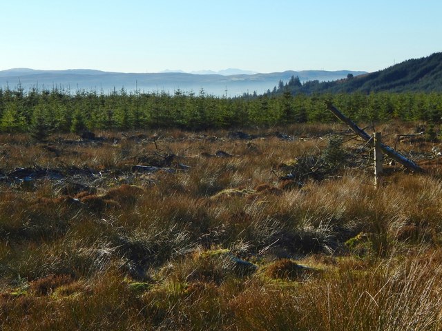
Forestry land on Darleith Muir
The view is from the path, which is part of the John Muir Way and the Three Lochs Way. Part of the wooded ridge of Killoeter is at the far right. The hills of Arran can be seen at the centre of the skyline.
 Map © Crown Copyright")
TIP: Click the map for more Large scale mapping
- Grid Square
- NS3582, 35 images (more nearby 🔍)
- Photographer
- Lairich Rig (more nearby)
- Date Taken
- Wednesday, 23 November, 2016 (more nearby)
- Submitted
- Monday, 5 December, 2016
- Subject Location
-
OSGB36:
 NS 3540 8205 [10m precision]
WGS84: 56:0.1834N 4:38.4745W - Camera Location
-
OSGB36: NS 3545 8209
- View Direction
- Southwest (about 225 degrees)