2016
NS3482 : Path to Goukhill Muir
taken 7 years ago, near to Dumfin, Argyll And Bute, Scotland
This is 1 of 6 images, with title Path to Goukhill Muir in this square
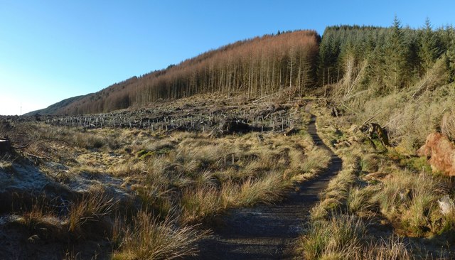
Path to Goukhill Muir
The path is part of the John Muir Way and the Three Lochs Way. This wide-angle view shows how the wooded Killoeter ridge extends from here to the south-west.
 Map © Crown Copyright")
TIP: Click the map for more Large scale mapping
- Grid Square
- NS3482, 107 images (more nearby 🔍)
- Photographer
- Lairich Rig (more nearby)
- Date Taken
- Wednesday, 23 November, 2016 (more nearby)
- Submitted
- Monday, 5 December, 2016
- Subject Location
-
OSGB36:
 NS 3486 8254 [10m precision]
WGS84: 56:0.4361N 4:39.0115W - Camera Location
-
OSGB36: NS 3495 8250
- View Direction
- WEST (about 270 degrees)