2016
NN5485 : Hydro pipeline in the making
taken 7 years ago, 4 km S of Kinloch Laggan, Highland, Scotland
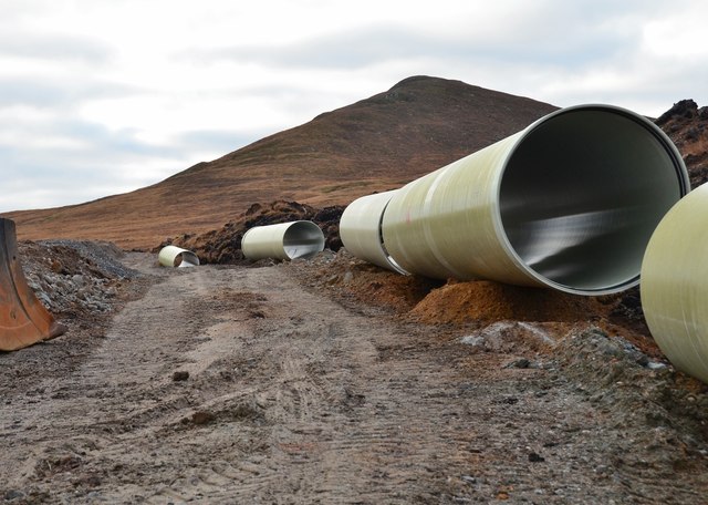
Hydro pipeline in the making
Pipe sections made from glass reinforced plastic on the line of the pipe to carry water to the power house on the shore of Loch Laggan. The hill in the background is Meall a Chrotha.
Pattack Hydro scheme :: NN5486
In 2016 construction began on a 9MW hydroelectric scheme on the River Pattack in the Ardverikie Estate, Laggan. A dam will create a reservoir from which a buried pipeline will take water down to a powerhouse on the shore of Loch Laggan. The dam top is at 406m above Ordnance datum, limiting the reservoir extent to about 500m upstream.
 Map © Crown Copyright")
TIP: Click the map for more Large scale mapping
- Grid Square
- NN5485, 14 images (more nearby 🔍)
- Photographer
- Jim Barton (more nearby)
- Date Taken
- Saturday, 3 December, 2016 (more nearby)
- Submitted
- Tuesday, 6 December, 2016
- Subject Location
-
OSGB36:
 NN 5449 8588 [10m precision]
WGS84: 56:56.4746N 4:23.6027W - Camera Location
-
OSGB36: NN 5449 8588
- View Direction
- South-southwest (about 202 degrees)