2013
SK0300 : Beside the Boathouse - Walsall, Staffordshire
taken 11 years ago, near to Rushall, Walsall, England
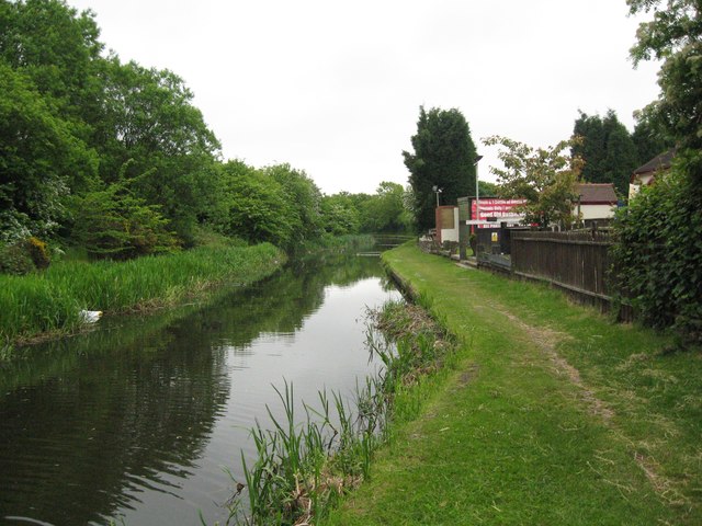
Beside the Boathouse - Walsall, Staffordshire
A view of the Daw End Branch Canal, taken beside the Boathouse pub which stands immediately north of Daw End Bridge. The Daw End Branch Canal opened in 1803 to transport coal and limestone from local workings to the Black Country furnaces. It runs from Catshill Junction SK0404 to Longwood Junction SP0499 a distance of 5.25 miles. It being a contour canal, there are no locks along its length. The placename Daw End is locally pronounced as Doe End. Time taken 9.40 am BST (British Summer Time).
 Map © Crown Copyright")
TIP: Click the map for more Large scale mapping
- Grid Square
- SK0300, 35 images (more nearby 🔍)
- Photographer
- Martin Richard Phelan (more nearby)
- Date Taken
- Wednesday, 5 June, 2013 (more nearby)
- Submitted
- Tuesday, 13 December, 2016
- Subject Location
-
OSGB36:
 SK 0327 0061 [10m precision]
WGS84: 52:36.1960N 1:57.1890W - Camera Location
-
OSGB36: SK 0328 0056
- View Direction
- North-northwest (about 337 degrees)