2016
SP7559 : Delapré Abbey, Northampton
taken 7 years ago, near to Northampton, West Northamptonshire, England
This is 1 of 9 images, with title Delapré Abbey, Northampton in this square
Delapré Abbey, Northampton
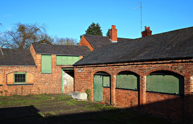
A disused Victorian farmyard on the Delapré Abbey estate (or more correctly, the estate of The Abbey of St Mary de la Pré (i.e. the Abbey of St Mary in the Meadow). The country house/former monastery itself is situated off the A506 in the meadows of the River Nene, to the south of Northampton. Ransom Road runs behind this disused farmyard (note the television aerial on the roof of an adjacent former farm cottage), although the road is inaccessible to the walkers using the public footpath from which this photograph was taken.
 Map © Crown Copyright")
TIP: Click the map for more Large scale mapping
- Grid Square
- SP7559, 168 images (more nearby 🔍)
- Photographer
- David Hallam-Jones (more nearby)
- Date Taken
- Tuesday, 27 December, 2016 (more nearby)
- Submitted
- Tuesday, 27 December, 2016
- Subject Location
-
OSGB36:
 SP 7596 5919 [10m precision]
WGS84: 52:13.5411N 0:53.3616W - Camera Location
-
OSGB36: SP 7595 5918
- View Direction
- North-northeast (about 22 degrees)